CEE Seminar: Geospatial Technology - Saving the World's Past, Present and Future from Natural Hazards

Ch2M Hill Professor
Professor, Oregon State University
Abstract: This presentation explores examples of how expanded and effective usage of geospatial technologies now can help us proactively “save” the world through detailed mapping of our critical lifeline infrastructure to improve: 1) Monitoring, modeling, and analysis efforts to more precisely identify vulnerable infrastructure; 2) Planning for and understanding the potential impacts and damage extents associated with multiple hazards, 3) The conduct of post-disaster reconnaissance, damage assessments and rebuilding efforts; and 4) Digital preservation of infrastructure and other resources with significant cultural and historical importance that are unlikely to withstand major seismic forces lurking on the horizon. Ultimately, geospatial technology serves as the unifying glue to enable meaningful collaboration between science, engineering and public policy necessary for a resilient society capable of effectively responding and adapting to natural hazards.
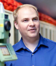
Bio: Michael Olsen is the CH2M Hill Professor of Geomatics in the School of Civil and Construction Engineering at Oregon State University. He serves as the technical director for the NSF Natural Hazards Engineering Research Infrastructure (NHERI) RAPID Facility, the director of the Cascadia Lifelines Program (CLiP), a member of the Partnership and Applications committee of the Cascadia Region Earthquake Science Center (CRESCENT), an associate editor of the ASCE Journal of Surveying Engineering, the past-president of the Surveying and Geomatics Educators Society (SaGES), and a co-founder and CEO of a tech transfer spinout company, EZDataMD, LLC.
Share
Related Content
| Attachment | Size |
|---|---|
| 261.51 KB |
Upcoming Events
-
MSE 298 Seminar: Molecular Modeling in the Age of AI - From Energy Materials to Device Simulations
-
CBE 298 Seminar: Metal Electrodeposition for Modern Mineral Refining
-
MSE 298 Seminar: Quasi-1D/2D Charge-Density-Wave Materials - From Exotic Physics to Application Prospects
-
CBE 298 Seminar: Finding Catalysts of Gut Reactions - The Gut Microbiota in Disease Onset and Treatment
-
MSE 298 Seminar: Basic Materials Science Aspects In Sustainable Metallurgy
